
A bit of a rare occurrence these days - but Emily managed to take some holiday to come home from Nottingham and spend some time with Catherine while she is on a break in her tour. I happened to have one day off during this time too. We wanted to make the most of this day the three of us had together. Having talked about doing the Monopoly board walk - literally by visiting each place on the board we decided to give it a go on Thursday evening after work. We Googled the idea and found a few blog entries by others who had done the same thing. Then with maps, the board game and time tables - we set about planning the route we wanted to take ready for the next day.

 When Friday morning arrived, despite the recent lovely weather, the sky turned dark as we prepared to leave. It was pouring with rain by the time Alan dropped us off to catch the train at Barnehurst Station. However once we arrived in London the rain had stopped. One thing is for sure, go had good value from our rail cards that day!
We discovered a lot of additional places along the way too. I have included a few photos of places other than those we were searching for.
 We decided to make a start at London Bridge so this was our GO! (1) We left the station and walked up onto the bridge via Tooley Street.
 We read that just here is purported to be the site of an old WATER WORKS (2), so we took a few pictures around this area. The Borough Waterworks Company formed in 1770, originally supplied water to a brewery and the surrounding area, which spanned the distance between London and Southwark Bridges.
This was the scene looking down over London Bridge and ...

... this is what the same spot looks like after walking down a few steps to go under the bridge.

This led us through Borough Market, known for its international foods .....

.... past the Golden Hind to the bank of the Thames.

Then we walked east along Bankside past Southwark Bridge the Shakespeare's Globe Theatre.

We arrived at the next destination on our list - Tate Modern - the site of an old ELECTRICITY (3) power station.

We retraced our steps and took a photo of The Clink Prison Museum - which we could have counted for JAIL, but we had something else in mind for this.

We arrived back in London Bridge Station via Tooley Street.


Not a lot of interest here to photograph - traffic, shops and flats mostly, so at this bus stop and hopped on a bus and headed off back to the Thames and alighted on the south end of Tower Bridge.


 We were keen to visit to see The Tower of London Remembers - The amazing ceramic poppies appear to be bleeding from a bastion window - representing infantrymen at the
Somme to mark the centenary of World War I. We spent a while here walking all around and taking photos. Hopefully we can return and spend more time exploring another day.
We were keen to visit to see The Tower of London Remembers - The amazing ceramic poppies appear to be bleeding from a bastion window - representing infantrymen at the
Somme to mark the centenary of World War I. We spent a while here walking all around and taking photos. Hopefully we can return and spend more time exploring another day.From here we tried to find the Mayor's Office (6) to count for Community Chest, but we had trouble finding it and decided we should have picked the old County Hall building at Waterloo instead. However we found we had arrived at our next destination - FENCHURCH STREET STATION (7). We approached this station from Cooper's Row and I have since discovered it is much more attractive from Fenchurch Place.
We continued walking from here towards Aldgate and found the next street on our list VINE STREET (8).
A very short cul-de-sac we walked the length of trying to find something interesting to photograph. It seems strange it was included on the board game. It is tucked away behind Piccadilly, I read there was once a police station here and the theory is that it was included in the orange group of properties because of its connection with the law.

Then we continued to walk on past Aldgate East Station to find WHITECHAPLE ROAD (9) and a rather sad looking road sign.


 The area has at various times been rife with poverty and crime. We stopped by Altab Ali Park formerly
known as St. Mary's Park it is the site of the old 14th Century white chapel, St.
Mary Matfelon, from which the area of Whitechapel gets its name. The chapel was bombed in the Blitz. the park has been renamed for a 25-year-old
Bangladeshi who was murdered nearby in 1978.
The area has at various times been rife with poverty and crime. We stopped by Altab Ali Park formerly
known as St. Mary's Park it is the site of the old 14th Century white chapel, St.
Mary Matfelon, from which the area of Whitechapel gets its name. The chapel was bombed in the Blitz. the park has been renamed for a 25-year-old
Bangladeshi who was murdered nearby in 1978.Retracing our steps again back to Aldgate East Underground Station we caught a Hammersmith and City Line train to LIVERPOOL STREET STATION (10). We had a short break here for a drink and a sandwich.

Next we could either take a 205 bus or the tube and we decided on the Hammersmith and City Line to Moorgate, then switched to the Northen Line to arrive at THE ANGEL, ISLINGTON (11). The strange thing is, this place is neither a street or a station on the board. It's name comes from a pub which no longer exists. The site is at the junction of Islington High Street and Pentonville Road where there appears to have been a coaching inn, around 1225. It is now known as 'The Angel' and was rebuilt in the 17th and 19th centuries. In the 1920's it became a Lyons Corner House which survived until the late 1950's. It was derelict until the 1980's when it opened as a branch of the Co-op bank. There is now a newer pub called 'The Angel' next door.


 |
| Platform 9 3/4 |

We didn't need to move far to capture the other end of PENTONVILLE ROAD (13) already seen at Angel Islington and ...

... EUSTON ROAD (14) both of which lead away from the station in opposite directions.

The Central Line took us to Baker Street where we changed for the Bakerloo Line and one more stop to MARYLEBONE STATION (15).

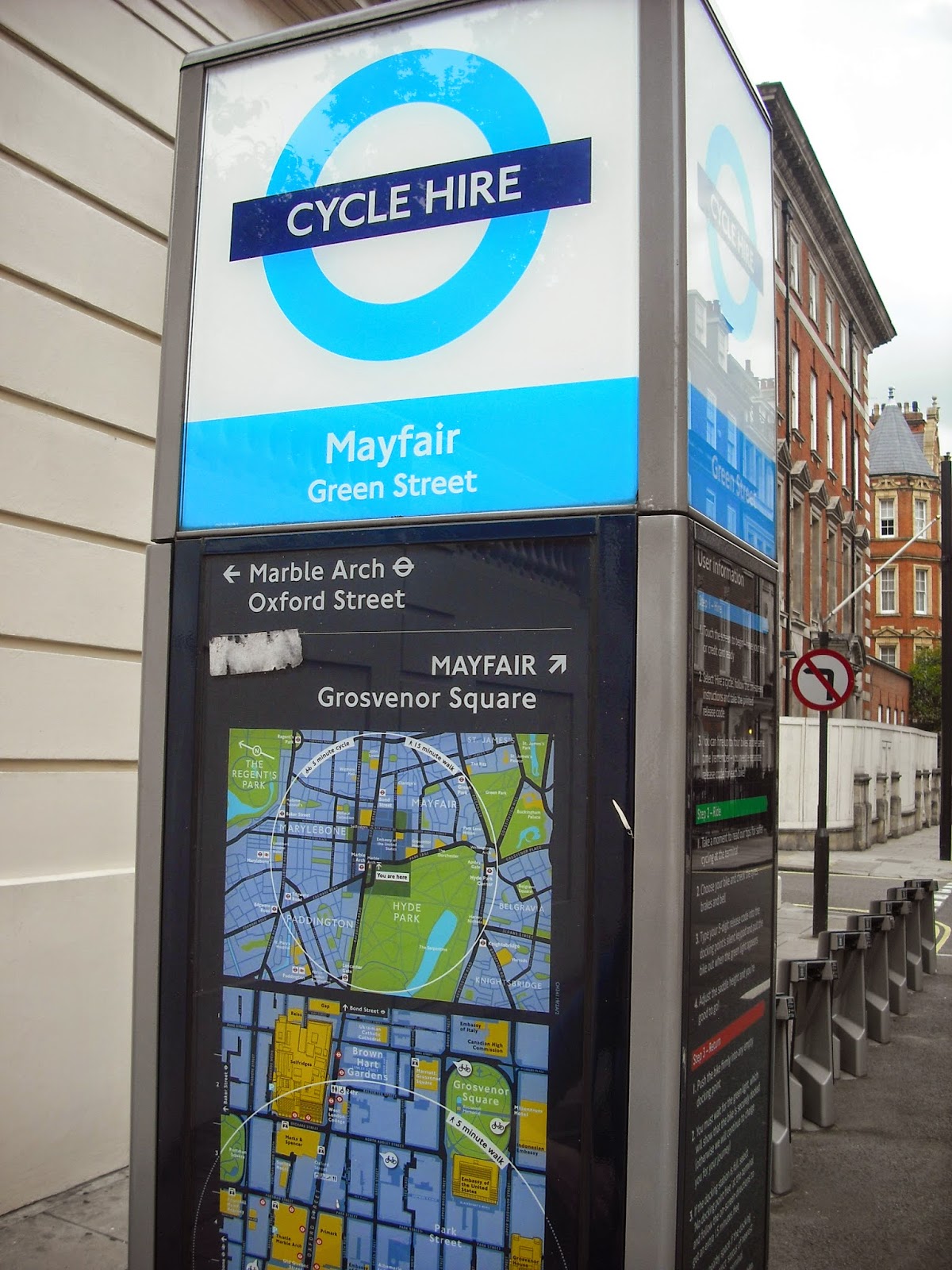
We decided to have a break from the tube and took a No. 2 bus to Marble Arch. The bus stop was in PARK LANE (16) ....

... which is set in the heart of MAYFAIR (17), in London’s popular West End.
Walking back to Marble Arch brought us to the west end of OXFORD STREET (18), where we would have been tempted to go shopping but we had many more stops to make and our feet were already very tired, but it didn't stop us window shopping on the way past. Here is Selfridges with it's grand façade.

Walking the along Oxford Street we stopped at BOND STREET (19) Underground Station, and just beyond this is NEW BOND STREET a turning off Oxford Street. Bond Street is famous throughout the world for its
wealth of elegant stores.

Continuing on Oxford Street we walked to Oxford Circus, which is the junction with REGENTS STREET (20) where we popped into Hamleys, the oldest and largest toy shop in the world.

On the way down Regent Street, before you get to Hamleys, you cross GREAT MARLBOROUGH STREET (21) which leads into Soho. It is unknown why the 'Great' was dropped when the board game was developed.

We couldn't resist a quick look in Liberty's as Emily had not been there before, but no time to stay long.

Our walk continued down as far as PICADILLY (22) where we stopped for a welcome cup of tea. Picadilly begins at Hyde Park Corner and ends at Piccadilly Circus,
this grand street is a mile long but today we just stayed in Picadilly Circus.

 Leading off Picadilly Circus is COVENTRY STREET (23), a short but busy street running between Piccadilly Circus and Leicester Square, and is named after
Henry Coventry, Charles II's Secretary of State. We didn't get a very good photo, it was so very busy it was difficult to stand still!
Leading off Picadilly Circus is COVENTRY STREET (23), a short but busy street running between Piccadilly Circus and Leicester Square, and is named after
Henry Coventry, Charles II's Secretary of State. We didn't get a very good photo, it was so very busy it was difficult to stand still!Reluctant to stand and walk again after our break, we managed to head off for LEICESTER SQUARE (24). Being August it was difficult to see an unoccupied bench or patch of grass in the square. Originally laid out by the Earl of Leicester II with Leicester House, a mansion on the north side and Leicester Fields in the centre. The main attraction now is all the cinemas and film premières.

Famous tourists attraction and meeting place complete with Nelson's column, fountains and lions. Often used as a venue for concerts, New Year celebrations, public meetings and demonstrations. Also home of the National Gallery.
The next four streets we needed all lead off Trafalgar Square, so not too far to go for a little while.
First we headed to PALL MALL (26). Leading towards the area of London known as St.James. The road is named for a 17 century game called 'paille-maille' played by the aristocracy in nearby St.James Park.

Next came WHITEHALL (27) Whitehall is where many ceremonial rituals of the monarchy and the military take place. Twice a day the Changing of the Guard takes place at Horse Guards Parade. The Cenotaph is where the Remembrance day service takes place every November at the memorial service to remember our war heroes.

Another road leading away from Trafalgar Square towards the Embankment is NORTHUMBERLAND AVENUE (28) is a much quieter place. We saw several Hotels and restaurants.

We left Trafalgar Square via THE STRAND (29) housing theatres, shops, churches and the famous Savoy Hotel in all it's Art Deco glory. With Charing Cross Station at the Trafalgar Square (south west) end it runs through to Aldwych at the other (east) end.

From outside Charing Cross we decided we needed to catch a bus to FLEET STREET (30). This was an interesting stop as until recently Fleet Street was the centre of the British newspaper printing industry.
It is a major road joining the City with the West End. There are some interesting pubs, Britain's oldest bank, Child & Co. has been located at no.1 Fleet Street since 1673. Fleet Street was also known as the address of Sweeney Todd's barber shop.
It is a major road joining the City with the West End. There are some interesting pubs, Britain's oldest bank, Child & Co. has been located at no.1 Fleet Street since 1673. Fleet Street was also known as the address of Sweeney Todd's barber shop.


All in all it took us 12 hours from door to door. Not sure how many miles we travelled or how many of those miles we walked.
If you made it to the end of this post without falling asleep - well done and thanks for looking.
Hope it has inspired you to have a go one day.
Lynn x
Wow - what an achievement! I have probably been to most of those places in my time, but certainly not altogether . ... I loved all the history in the blog post, too! When I first went to London, I had the intention of visiting every tube stop on the Underground, but am sure I didn't achieve it .... Will make a brilliant mini book, if that's what you were planning to do with the pics x
ReplyDeleteAmazing Lynn, would love to try it sometime - sounds like good shoes needed! Sylvia x
ReplyDeleteWow Lynn. What a day and quite an acievement. Will we see a scrapbook layout - or two, about your adventure?
ReplyDeleteWell done you 3 ! What an amazing adventure, you must 've been exhausted at the end! I don't think my girls would be up for the challenge...not for a few years yet anyway!
ReplyDeleteFabulous idea, would love to have your route please :)
ReplyDelete